SERVICE AREA METRO VANCOUVER
Drone thermal roof capture, after dark. You do the analysis. I do the flying.
Night-time thermal and photo capture of commercial roofs and building envelopes across Metro Vancouver. Radiometric files (a temperature in every pixel) by next morning. White-label delivery available.
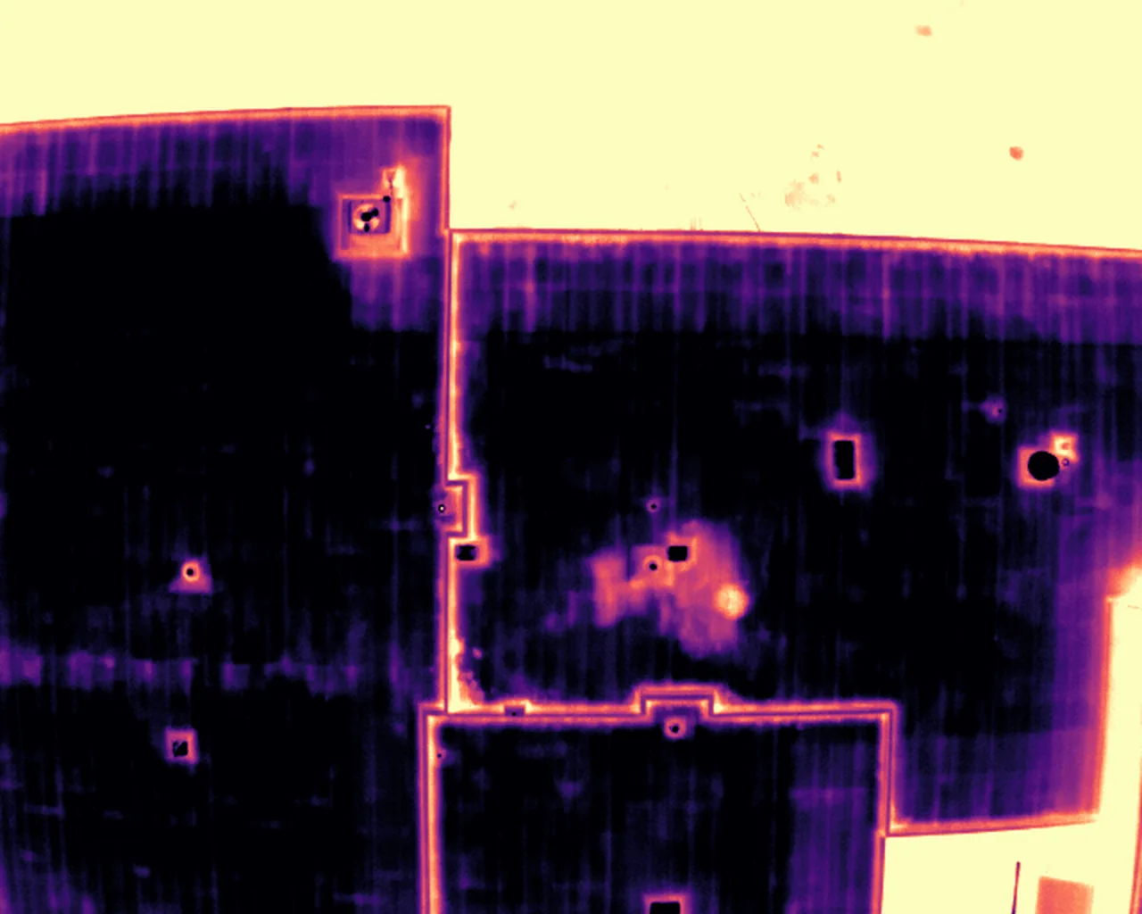
MAGMA PALETTE · 12.5 °C TO 18.0 °C · DARK IS COOLER
FILE DELIVERY
Next morning
CERTIFICATES
TC Advanced Ops · ROC-A
INSURED
$2M liability
FOUNDING RATE
$799
What you receive
IN EVERY DELIVERY
DETAIL
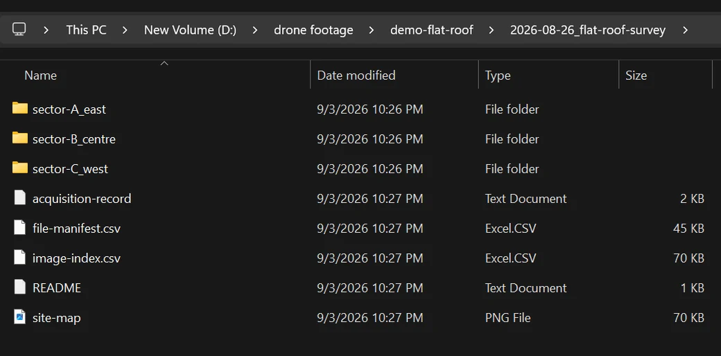
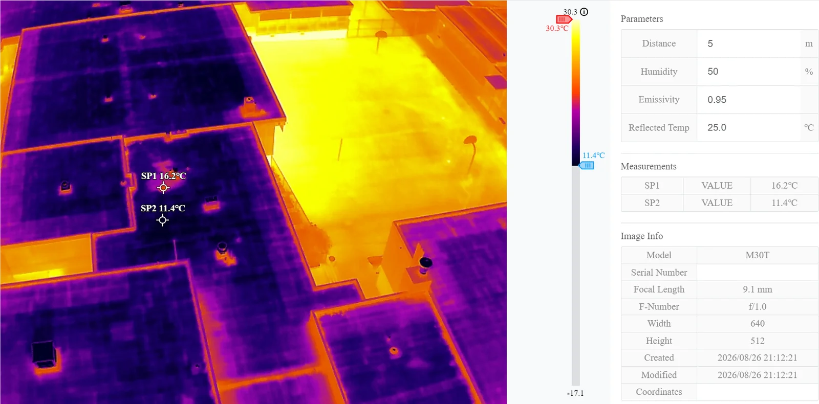
- 01 Thermal R-JPEG originals Radiometric, a temperature value in every pixel. Open them in DJI Thermal Analysis Tool 3 (free) or any radiometric viewer. DJI filenames or your project convention
- 02 RGB originals Same roof, paired to the thermal frames by position
- 03 Image index Filename, position, time, altitude, heading and roof location for every frame
- 04 Site map Coverage overview with every frame position plotted
- 05 Acquisition record Date, time, weather, camera angles and heights, known limitations
- 06 Manifest and README SHA-256 for every file, one paragraph on what the folder holds
Yours to use from delivery. Copyright passes to you on full payment.
WHOLE ROOF, TOP DOWN
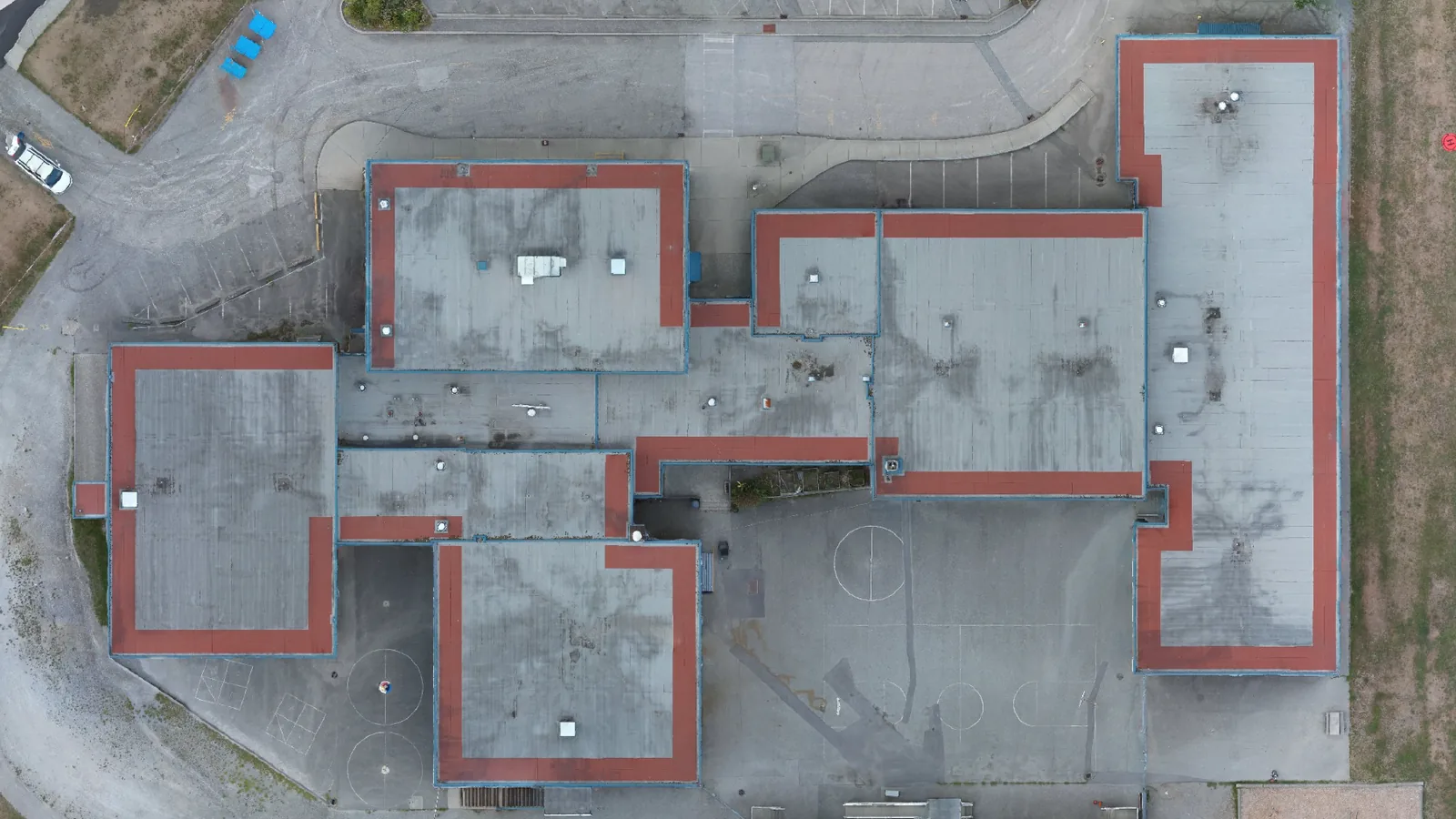
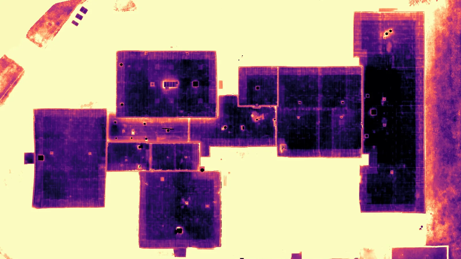
DRAG TO COMPARE OR USE ARROW KEYS
Thermal pane: magma palette on a processed mosaic, dark is cooler, light is warmer. The mosaic carries no temperature scale; the delivered R-JPEGs hold the temperatures.
CLOSE-UP PAIR
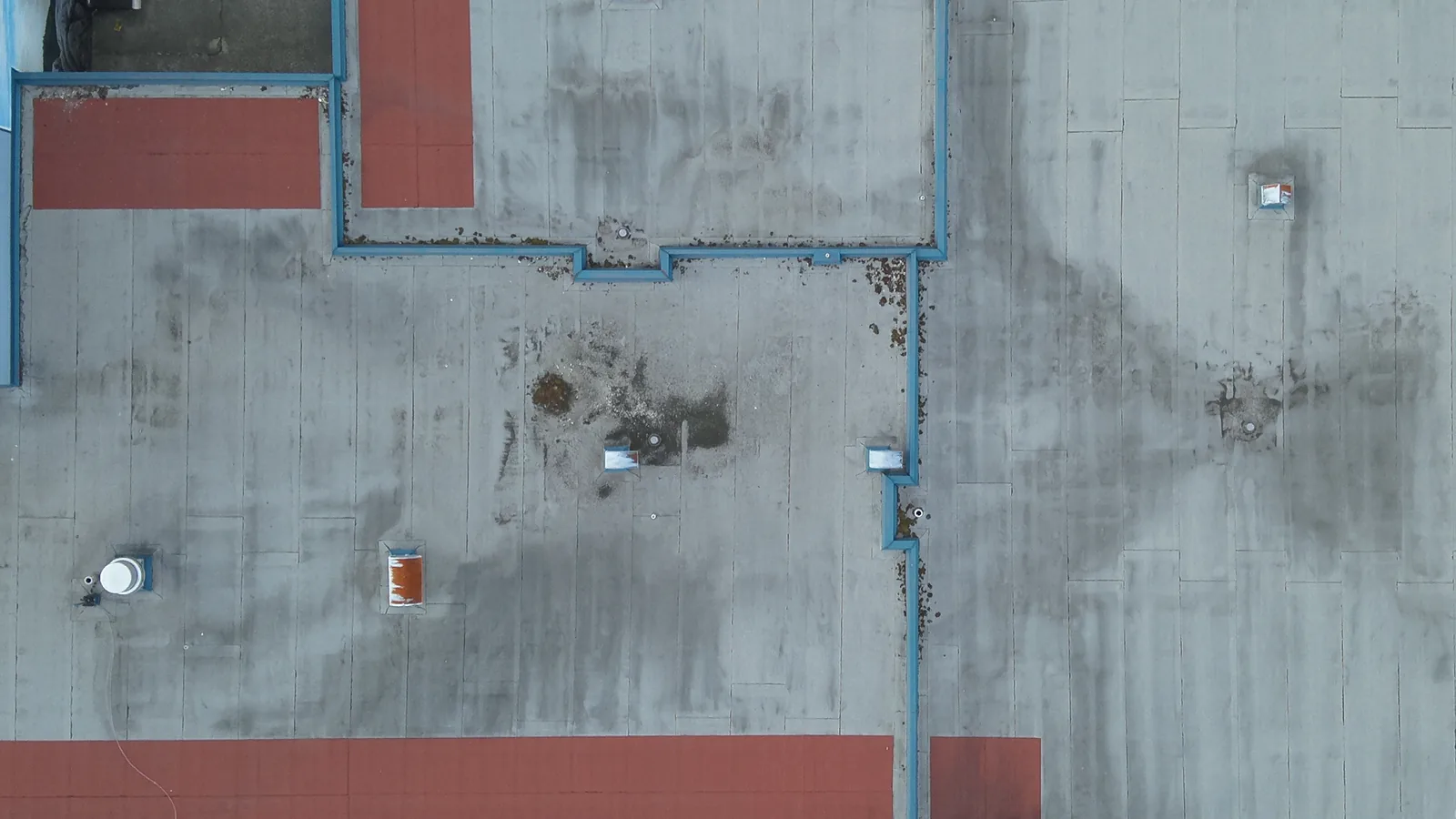
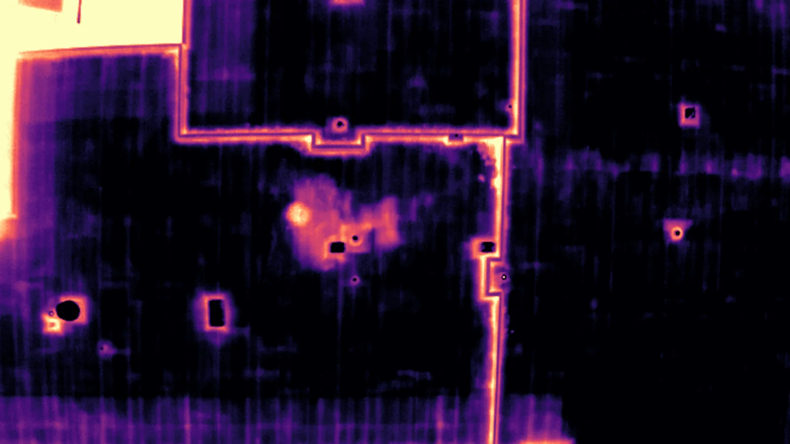
DRAG TO COMPARE OR USE ARROW KEYS
Thermal pane: magma palette, 12.5 °C to 18.0 °C display range, dark is cooler, light is warmer.
SAMPLE CAPTURE PACKAGE
Demonstration capture, not client work. Elementary school, Port Moody, captured 26 August 2026, thermal pass after sunset. The zip holds four R-JPEG thermal originals, four RGB originals, the image index, site map, acquisition record and SHA-256 manifest.
Capture only. Interpretation stays with your team.
Thermal Sky captures and delivers the agreed data. No diagnosis, no findings, no repair advice, no client-facing reporting from Thermal Sky. Your team performs all interpretation and reporting.
THERMAL SKY
- Flight planning to your scope
- Radiometric thermal capture
- Matched RGB capture
- Geotagged image index and acquisition record
- File delivery by the next morning
- White-label delivery available
- Files and naming follow your project conventions
YOUR TEAM
- Interpretation of the radiometric data
- Analysis and findings
- Client-facing reporting
- Recommendations and scope of work
- The client relationship
How a capture works
-
01
Request
Site address, approximate roof or building area, thermal or RGB, capture scope or protocol, and access notes.
-
02
Confirm
Scope, roof area, distance, and the capture window are confirmed in writing before anything is booked.
-
03
Capture
Flown on the first suitable evening within the agreed 3 to 5 day window.
-
04
Deliver
Radiometric thermal files, matched RGB, image index, and the acquisition record by the next morning.
Fixed price for a defined scope
Founding rate applies to each client's first project, limited to the first three clients. Standard rates apply after that.
Tier 1 capture
One job, one visit. Any of:
- Roof thermal, a single strata, warehouse or commercial roof up to about 30,000 sq ft
- Building-envelope thermal, one building up to four storeys, all elevations
- RGB and zoom documentation of a roof or facade, no thermal
FOUNDING RATE
$799
STANDARD RATE
$1,199
Tier 2 capture
One job, one visit:
- Roof thermal, a large roof about 30,000 to 80,000 sq ft
FOUNDING RATE
$999
STANDARD RATE
$1,399
SCOPE AND TERMS
DETAIL
- Standard scope A single roof or a single building, a single visit, within about 1 hour of Port Moody. Sites outside that are flagged at confirmation, before anything is booked.
- Scheduling First suitable evening in a 3 to 5 day window. Rescheduling for weather is at no charge.
- Season Roof thermal is not scheduled November to February. Building-envelope thermal runs in that window.
- Storm and water damage Quoted the same day it is requested. 24 to 48 hour capture target when daylight and conditions allow.
- Outside the tiers Five or more storeys, a roof over 80,000 sq ft, or more than one building. Quoted within 24 hours.
Invoice on delivery · Net 15 · Prices in CAD
OPERATOR
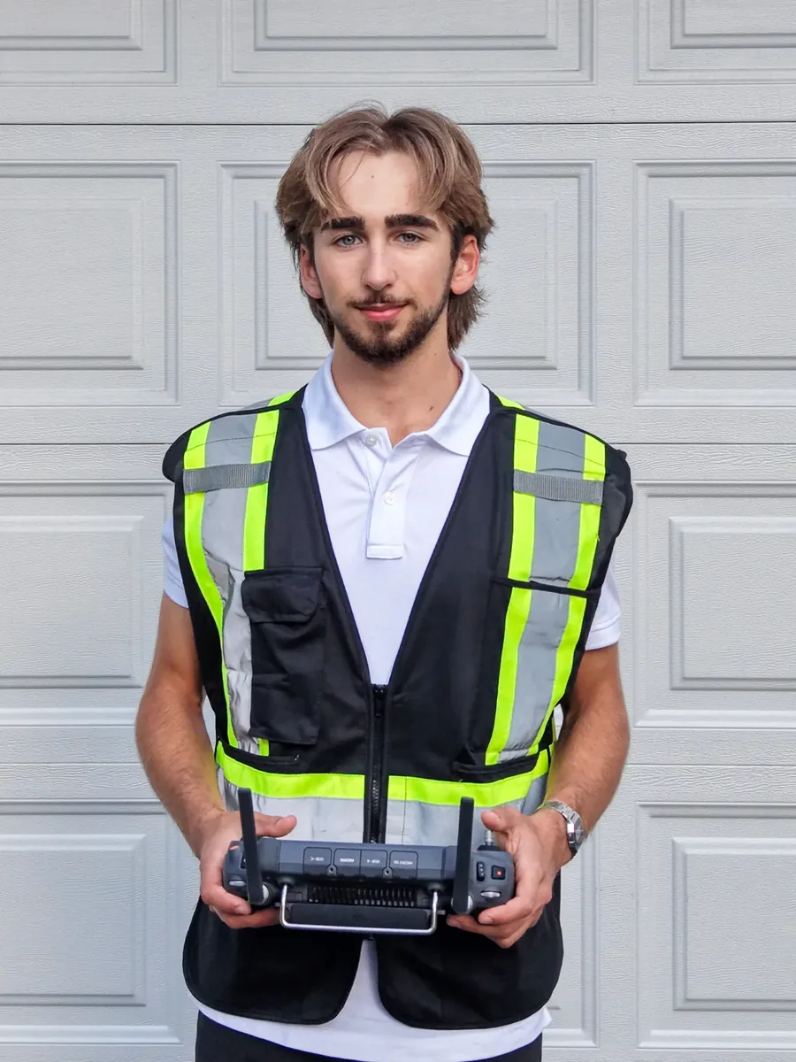
Daniel Sabitoff
I hold a Transport Canada Advanced Operations pilot certificate and have five years on the controller. I fly a DJI Matrice 30T. I am a civil engineering student at BCIT, based in Port Moody, and I plan and fly every capture myself.
604-330-3335 · daniel@thermalsky.ca
CREDENTIALS
TRANSPORT CANADA
Pilot Certificate, Advanced Operations
RADIO
Restricted Operator Certificate, Aeronautical (ROC-A)
INSURANCE
$2 million liability. Certificate of insurance available on request.
INTRODUCTION
DRONE
DJI Matrice 30T
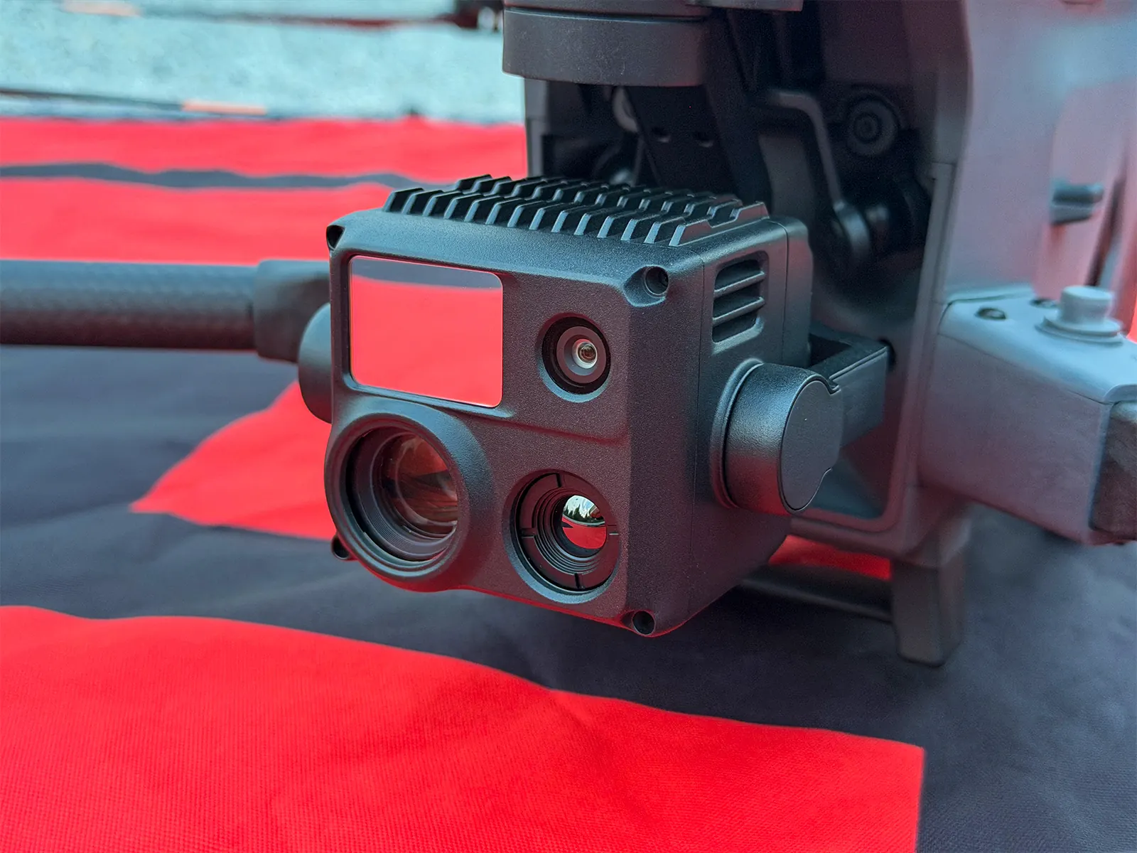
- THERMAL SENSOR
- 640 x 512 radiometric
- THERMAL SENSITIVITY
- under 50 mK NETD
- RGB CAMERAS
- 12 MP wide + 48 MP zoom, captured alongside thermal
- REGISTRATION
- C-2430059640
Common questions
Is this a roof inspection?
No. A roof inspection or moisture survey is an opinion about the roof, and that comes from your thermographer, building-envelope consultant or roofing contractor. I fly the drone and deliver the infrared roof scan as radiometric files, so your team does the thermal imaging analysis and puts its own name on the report.
How far do you travel?
Metro Vancouver, roughly a 60 minute drive from Port Moody: Vancouver, Burnaby, Coquitlam, Port Coquitlam, New Westminster, Surrey, Richmond and North Vancouver. If your site sits outside that, ask and I will tell you plainly whether I can reach it on a weeknight.
When do I get the files?
The morning after the capture evening, and never later than the end of the next business day. Delivery is a private link to your named email address.
What happens if the weather is wrong?
Capture is scheduled for the first suitable evening within an agreed 3 to 5 day window. When thermal preconditions are not met, I reschedule inside that window at no charge.
Who owns the files?
Your team can use the files from the moment they arrive. Copyright is assigned to you on payment of the invoice (Net 15). After that there are no restrictions and no usage limits.
How does white-label delivery work?
I have no contact with your client. Delivery is white-label on request: no Thermal Sky branding anywhere, and files and naming follow your project conventions, so the pack drops straight into your own deliverable.
I manage a strata. Who reads the files?
Your building-envelope consultant or roofing contractor. If you do not have one, ask and I will tell you plainly who in Metro Vancouver does this kind of analysis. I do not interpret the files myself.
Do you need site access?
Usually not. Most roofs are flown from adjacent ground within visual line of sight. Access needs are confirmed per site before the capture window is agreed.
Are you certified and insured?
I hold a Transport Canada Pilot Certificate, Advanced Operations, and an ROC-A radio certificate. $2 million liability coverage, certificate of insurance available on request.
Why evenings?
After sunset, solar loading is gone, so temperature differences come from the roof or the wall, not the sun. Roof thermal also needs a dry roof and a clear night.
Do you capture walls as well as roofs?
Yes. Building-envelope thermal runs November to March, when a heated building against a cold night gives the temperature difference the physics needs. Each elevation is flown at a set standoff distance with matched RGB. Same files, same folder structure, same next-morning delivery.
Can you document storm or water damage?
Yes. RGB and zoom stills of the roof, facade and affected area, geotagged and time-stamped, delivered the next morning for your adjuster or project manager. No cause-of-loss opinion from Thermal Sky. Light rain and overcast are fine for RGB; heavy rain and fog are not.
Request a quote
REQUEST SENT
Thank you. Your request is in. I reply from daniel@thermalsky.ca with a quote, usually the same evening.
The request did not send. Email daniel@thermalsky.ca instead.